
Plainfield Neighbor Records by Block
Public sources describe a Plainfield block in layers. Parcel maps show lot shapes and adjacent sites. Assessment rolls name the recorded owner and may give a separate mailing address. Village maps show whether the same site is inside the incorporated boundary, while planning and preservation records explain zoning or historic-district context. Those facts can help identify the right custodian, but they do not list every person in a home. Plainfield crosses Will and Kendall counties, so county identity must come from the parcel and boundary evidence, not the word “Plainfield” in a mailing address.
| Source | What It Shows About a Block | Access |
|---|---|---|
| Will GIS Data Viewer | Parcels, address points, streets, municipality, zoning, districts, and map context | Public viewer with identify, buffer, and export tools |
| Kendall GIS Map Viewer | Adjacent, overlapping, current, and retired parcels with site and assessment fields | Public map, side panel, and parcel layer |
| County assessment rolls | Owner, site address, mailing address, sale, tax, and legal fields that vary by county | Will AddressSearch or Kendall Devnet |
| Village boundary and planning files | Municipal status, zoning, surveys, and preservation context | Public maps, office pages, and FOIA |
| PAPL local history sources | Old maps, directories, newspapers, structures, and street-name context | Digital collections, library help, and microfilm |
An owner name is not an occupant list. The mailing address may point elsewhere, a parcel can contain several units, and a retired parcel can reflect land history rather than a current home. USPS likewise says its ZIP result does not confirm a person or company at an address. Treat the rolls as separate pieces of evidence. When the goal expands from the few lots around one home to a full named road, use the Plainfield street directory workflow.
See Plainfield Neighbors in Will GIS
The Will County GIS Data Viewer guide documents the right tools for a block search. Turn on parcels, address points, streets, municipalities, zoning, and only the district layers needed. Search or geocode the target street, then use Identify to inspect a lot. Buffer can select features around it. The county also documents measure, labels, street view, bookmarks, CSV addition, printing, and image export. Map geometry is useful context, not legal proof of a line or proof that an owner lives there.
The county’s vector-data catalog identifies parcel, road, address, political, school, FEMA, and PLSS layers and notes update cycles. That helps date a screen capture. Follow a parcel name or PIN into the official assessment roll before recording an owner. Address points and streets may be updated weekly while other layers have a different date, so save the source date with each result.
The official Will viewer is visible below. Its layer list shows why a block search works best as a geographic check rather than a list of people.
Open the Will County GIS viewer guide used in this Plainfield neighbors search.
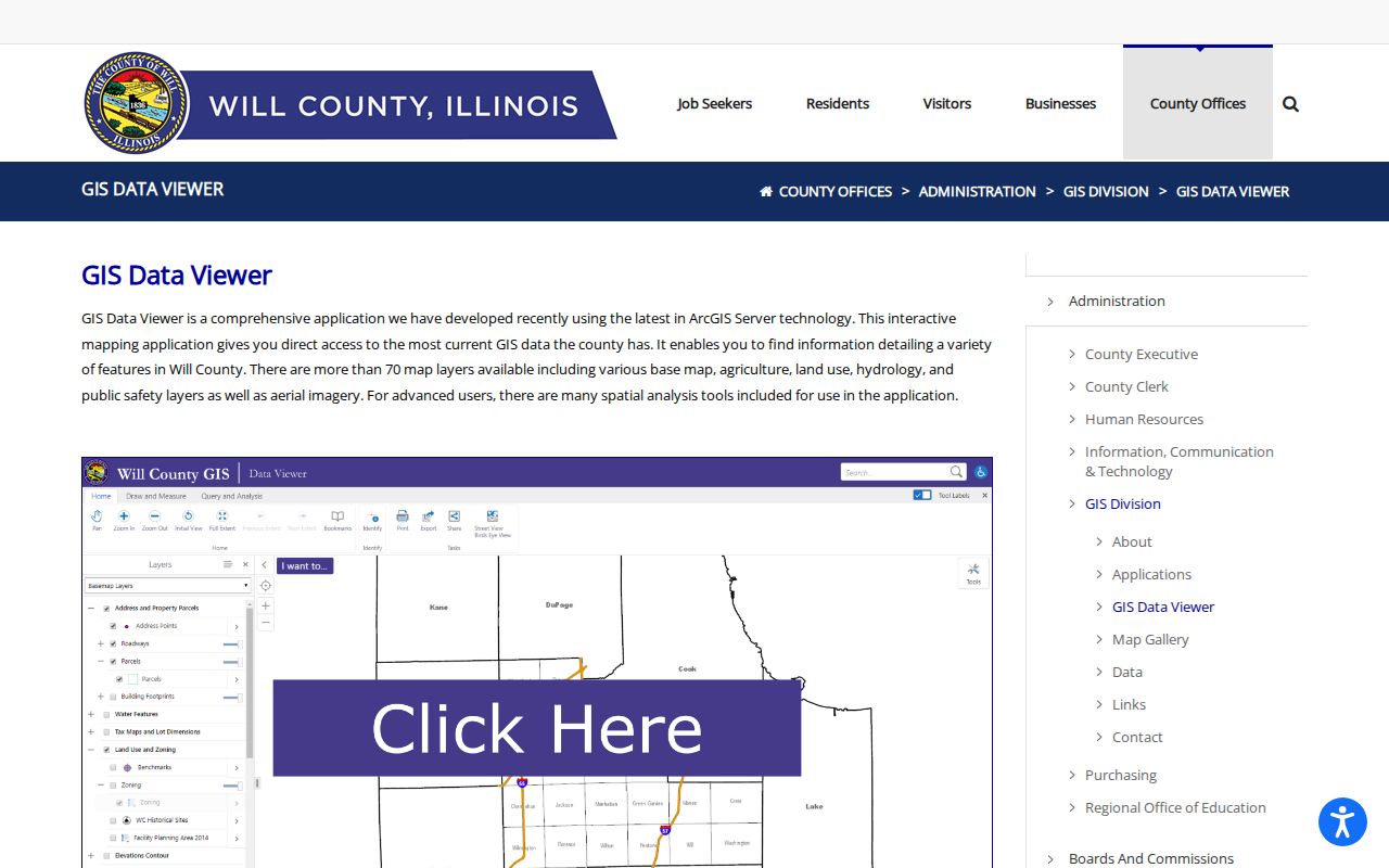
The captured guide points back to county-maintained map tools, where parcel and street context can be checked against the current layer dates.
The Will County layer catalog also shows the official data groups available for block context.
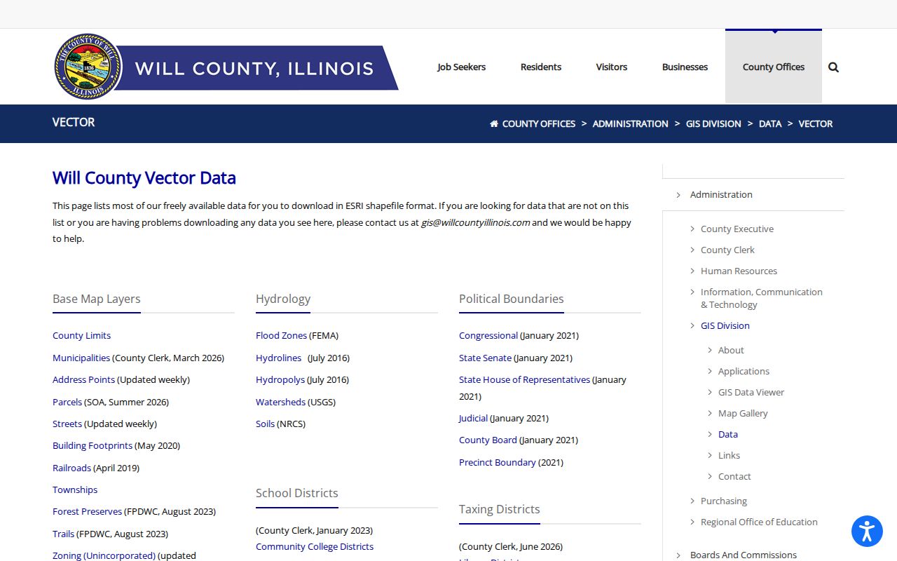
This second view supports the distinction between parcel, address, road, municipal, and district layers, which should be checked separately.
Check Plainfield Neighbor Parcels in Kendall
Kendall County uses a different map and assessment chain. In the Kendall County Map Viewer, search by site address or PIN, select the parcel, and page through side-panel results when units or lots overlap. The county parcel layer includes current and retired parcels. It also exposes creating and retiring document fields, which can explain why an older PIN no longer appears as current. A geometry match still is not a person match.
The official property quick-lookup guide provides the county’s search sequence. Its screen is shown here because it makes the panel workflow clear.
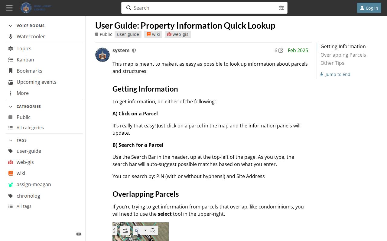
Once the correct parcel is selected, compare site address, owner, assessment, district, and retirement fields rather than relying on one matching label.
For a wider technical view, the Kendall current and retired parcel layer can be queried by parcel fields or geometry. Use the Recorder document named by the layer to verify a parcel change. Do not infer a household from a map feature.
Plainfield Blocks Cross County Systems
The postal city name does not settle jurisdiction. Compare the target street with the Village of Plainfield municipal boundary service, then confirm whether the parcel lies in Will or Kendall County. This fork controls which assessor, Recorder, Circuit Clerk, voter office, sheriff, and vital-record custodian holds a record. It also prevents a blank result in one county from being mistaken for proof that no record exists.
Will’s assessment search accepts street number, street name, and city or town. A broad street-only query can return several lots. Kendall Devnet accepts low and high house numbers, street name, and city, which can frame a block range. Both systems keep site and mailing information distinct. The Village boundary shows incorporation, while the county parcel establishes the county record path. One boundary should never stand in for the other.
Two-county check. Confirm the parcel and municipal boundary before choosing a Plainfield records office; the postal label alone is not enough.
Map a Plainfield Neighbor Block
Keep the radius small and the source chain clear. The task is to understand nearby parcels, not compile personal profiles. Begin with one normalized street address and preserve the date of every source used.
- Check the Village boundary service and the county parcel layer. Choose Will or Kendall from the parcel evidence.
- Open the correct county GIS viewer. Search the site address or PIN, then turn on parcels, addresses, streets, and municipality layers.
- Select only the adjoining parcels. In Will, use Identify or Buffer; in Kendall, use Select and page through overlapping results.
- Open each parcel in the county assessment system. Keep site address, recorded owner, and mailing address in separate notes.
- Use Village planning, historic surveys, or library sources only for relevant place context. Record the source date and do not infer who occupies a home.
This flow can establish which lots surround an address and which owner names appear on a dated roll. It cannot establish all Plainfield neighbors who live on the block. Apartments, family members, renters, protected addresses, and recent moves may not appear in the selected sources.
Voter Records Do Not Browse Plainfield Blocks
The Illinois voter registration lookup is a one-person confirmation form. It requires first name, last name, birth date, five-digit ZIP, street number, and street name. It does not return a street roster or let a visitor browse nearby voters. That makes it unsuitable as the lead source for finding Plainfield neighbors.
Kendall County’s voter information guide supports address or parcel lookup for district and voting information. A separate county voter-data request has stated requester classes, formats, and fees. No current public Will County browse-by-street interface was confirmed in the research. Use election tools to check registration or district facts within their stated rules, not to promise a household list.
Note: A blank voter result may reflect the exact-match form, protected data, or registration status; it does not prove an address is vacant.
Community Records Around Plainfield Neighbors
No centralized official Plainfield HOA or household-member directory was located. Public community sources instead document institutions, district boundaries, meetings, history, and preservation work. That distinction matters. A subdivision name in a parcel record can guide a question to Planning or a county office, but it does not expose an association roster.
Village Planning and Preservation
Historic Preservation publishes district, survey, and commission context. Public meeting files may be requested through Village channels.
Plainfield Library History Desk
PAPL local history connects maps, newspapers, yearbooks, societies, and older community records. Current private rosters were not found.
Historic District Sources
National Register resources describe the Downtown district and listed sites. They document places, not current residents.
The Downtown Plainfield Historic District follows Lockport Street between Route 59 and James Street and includes 53 properties. The Village also documents the East Side Historic District and local survey resources. Those materials can explain the age and form of a block. Congregation, civic club, block-watch, fraternal, and current association membership lists were not found in the official source sweep, so membership should never be inferred.
Official Plainfield Rolls and Neighbor Tools
Commercial neighbor tools may combine names, phones, addresses, and old data without showing how each fact was sourced. County and Village systems are narrower, but they identify the custodian and record date. For personal block research, a smaller official fact is usually easier to verify than a large compiled profile.
| Source type | Useful for | Main limit |
|---|---|---|
| County GIS and assessor | Parcels, site address, recorded owner, map context | Does not list every occupant |
| Village planning and history | Boundary, zoning, surveys, district context | Not a household directory |
| Commercial compiled tool | Possible leads from mixed databases | Source date, identity matching, and accuracy may be unclear |
Verify a compiled claim at the office that controls the underlying record. Do not merge parcel ownership, voter confirmation, court detail, phone data, and historical names into a profile of a Plainfield neighbor.
Plainfield Neighbor History on the Map
The block around an address can change even when a street name looks stable. PAPL holds 1873, 1893, and 1909 Will County atlases, local newspapers, directories, cemetery material, and house-history resources. A current parcel can be compared with these sources to see older roads, farms, lots, structures, and notices. The comparison is a place-history exercise, not a claim that a person named in an old item has a present tie to the site.
Will County’s map catalog adds road, rail, river, trail, address, parcel, district, and PLSS context. Kendall’s retired-parcel layer can show a creating or retiring document tied to a parcel change. For older Plainfield blocks, the PAPL house-history guide recommends maps, aerials, Sanborn maps, directories, newspapers, deeds, and assessment records as separate layers.
A useful local case is the historic district versus current parcel comparison. Map the Downtown district’s documented properties or an East Side street against today’s parcel boundaries and Village surveys. Keep uncertain street renumbering or annexation dates marked as unresolved; the research did not locate a single citywide readdressing project.
Privacy Bounds for Plainfield Neighbor Lookup
Illinois FOIA does not turn every government field into a public resident profile. Driver-record addresses are protected by state law. Birth records have eligibility limits, court files may be sealed or redacted, juvenile records have access limits, and the Illinois Address Confidentiality Program can substitute an address for a qualifying participant. Utility customer data was not located as a public Plainfield source. A parcel owner, tax mailing address, permit applicant, or historic-directory name should not be treated as proof of current residence.
Use the minimum facts needed. Save the agency, URL, query type, and retrieval date, then delete copied personal data that serves no purpose. If a government result is wrong or exposes a safety-sensitive address, contact the custodian that controls it. Village files go to the Village Clerk or FOIA officer, county parcel data to the assessor or Recorder, and confidentiality questions to the Illinois Attorney General program.
Lawful use. Research Plainfield neighbors only for lawful personal, civic, or historical reasons. Never use block records to track, threaten, harass, or intimidate anyone.