
Walk a Plainfield Street by Address
A street-by-street search works best as a sequence. Postal, municipal, parcel, deed, and historical systems can spell or classify the same place in different ways. Save the value shown by each source and its date. Do not silently replace a site address with an owner mailing address.
- Normalize the address through USPS, which does not confirm a person at the location.
- Check the Village boundary, then select Will or Kendall County.
- Open the assessor and GIS records to capture site address, PIN, and parcel context.
- Use the PIN or legal description in the appropriate Recorder route.
- Check permits, atlases, papers, and criss-cross directories for dated context.
This Plainfield street directory process can show who is named as an owner or party to a deed. It cannot create a complete household list.
Which Plainfield County Holds the Street?
Plainfield spans Will and Kendall Counties. A street’s postal city and ZIP cannot choose the county office. Check the Village municipal boundary service, then compare Will Data Viewer or Kendall Map Viewer. The county fork controls assessment, Recorder, court, election, permit, and Sheriff paths.
Will offices are mainly in Joliet, while Kendall offices are in Yorkville. A street segment near the county line can produce a valid Plainfield postal result yet belong to a different county portal than expected. When the map and typed address disagree, compare the parcel, municipal layer, legal description, and county address authority before continuing.
Will County Plainfield Address Search
Will Supervisor of Assessments Address Search accepts Street Address Number, Street Name, and City/Town. A number-only or street-only query can return many parcels, so use the city field and inspect each site address. The office says its address data comes from Will County 9-1-1. Address assignment or correction questions should go there.
| Will search | Fields | Useful result |
|---|---|---|
| Address | Number, street, city/town | Parcel linked to site address |
| PIN | Full or partial PIN, dashes optional | Tax and assessment context |
| Sales | Date and amount ranges, type, subdivision | Sale matches for comparison |
Open the Will County address form.
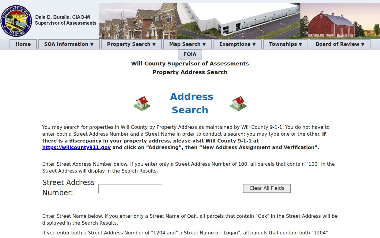
The captured fields show why number, name, and city should be searched together.
Kendall Plainfield Streets in Devnet
Kendall Devnet wEdge supports a range rather than one house number. Fields include Parcel Number, Owner Name, House Number Low and High, Street Name, City, sale-price and sale-date ranges, tax codes, tax districts, and legal description. That makes it useful for scanning parcels along one block.
Kendall GIS then adds the map. Its autosuggest accepts PIN or site address, and the select tool helps with overlapping parcels or condominium units. The published parcel layer carries current and retired parcels, creating and retiring Recorder document numbers, legal description, owner, mailing and site address, assessment, acreage, class, township, municipality, zoning, and districts. Its stated time extent begins in 1994, so older street work must move to the Recorder, library, atlases, and archival maps.
Plainfield Street Directory Record Coverage
Address-keyed sources overlap, but each answers a different part of the street question. This coverage table keeps a map result from being mistaken for a deed or a permit applicant from being mistaken for an occupant.
| Record | Keeper | Shows | Access |
|---|---|---|---|
| Assessment roll | Will SOA or Kendall assessment | PIN, owner field, site and tax context | Public portal |
| GIS parcel | County GIS | Geometry, streets, jurisdiction, districts | Public viewer |
| Recorded instruments | County Recorder | Parties, legal description, document trail | Online or research room |
| Permits | Will Land Use or Village offices | Application and site records | Portal, office, FOIA |
| Historical directories | PAPL | Dated name, address, or phone association | Digital and onsite |
The street directory chain is address to parcel, parcel to legal record, then dated supporting sources. Voter verification is for one known person and exact address, not a public street roster.
Map Plainfield Parcels and Layers
Will Data Viewer has more than 70 layers and tools for identify, measure, buffer, geocode, print, export, and CSV data. Its vector catalog reports weekly address-point and street updates, Summer 2026 parcel data, and separate zoning, municipality, township, school, political, FEMA, railroad, and trail layers. A buffer can describe parcels near a line, but it does not identify residents.
Kendall Map Viewer exposes current and retired parcel information. Its document-number fields are especially useful when a subdivision or parcel retirement changed an address. Confirm those numbers with the Kendall Recorder research room. GIS acreage has no legal bearing, and map geometry cannot replace a recorded plat or survey.
- Parcel
- A mapped land unit, usually keyed by a PIN.
- Situs address
- The physical site address, which may differ from mail.
- Plat
- A recorded map dividing land into lots or tracts.
- Criss-cross directory
- A directory ordered by street or phone rather than surname.
Deed Chains Along Plainfield Streets
Will Recorder’s guide supports names, organizations, PIN, address, and book/page searches. Address input uses street number and street name without suffix. Online documents typically run from 1965 to current; older records can be researched in the office or ordered by document number. Plats extend back to county inception.
For each parcel, locate the current transfer, record the document number and legal description, then follow the seller as grantor or grantee in the same parcel context. Do not jump to a matching surname on another street. Kendall’s official pages confirm deeds, mortgages, liens, and plats, but the public search URL and cutoff were not located. The research room at 502 S Main Street remains the authoritative fallback there.
Plainfield Permits by Street Address
Will SmartGov accepts permit number, site address without periods, or an owner, applicant, or contractor name. A parcel search can use the PIN without dashes or the site address, then open Applications and a permit number. Reports can be run and printed. The public instructions do not state the historical cutoff.
Open the Will Land Use public portal.
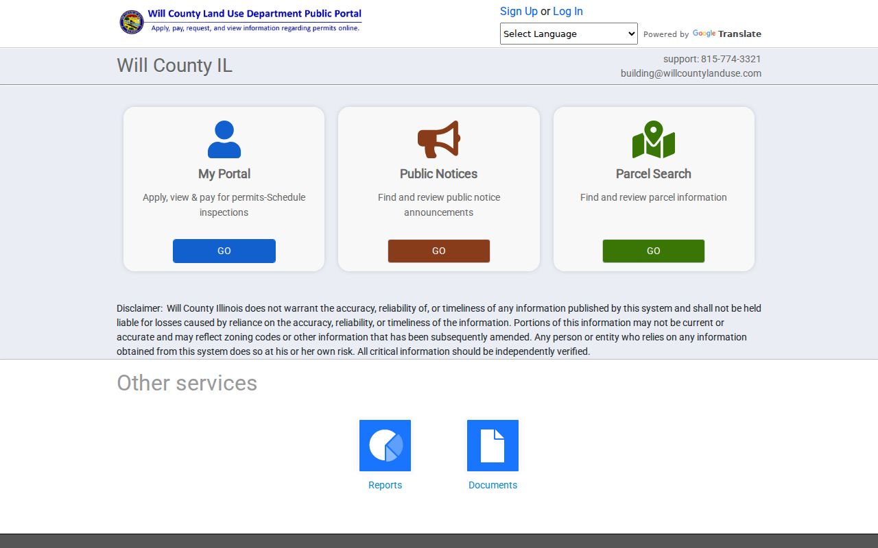
The permit portal adds project context to a parcel, not proof that an applicant owned or lived at the site.
Inside the Village, Planning handles zoning and historic forms. Building and Code Enforcement routes permits and complaints. Because a direct Village permit-search URL was not captured, use the office or a narrow Village FOIA request rather than inventing online coverage.
Historic Plainfield Streets Across Sources
PAPL’s house-history guide connects current parcels to the 1873, 1893, and 1909 county atlases, Sanborn maps, aerial photographs, local papers, survey forms, directories, and Recorder indexes. Its Plainfield and Lockport directories cover 1973-1993, while local phone runs reach roughly from the mid-1920s through the 1950s. For the collections themselves, use the Plainfield city directory shelf.
Downtown Lockport Street lies within a National Register district containing 53 properties. The East Side Historic District includes Amboy Street, Bartlett Avenue, Center Street, Illinois Route 59, and Evans Street. Plainfield also has about 700 Historic Urban Core survey forms and about 130 rural structure or farmstead forms. These sources can help match old map labels to present parcels.
No official local street-renumbering year was found. Treat an old address mismatch as an open research question. Compare legal descriptions, subdivision plats, atlases, county 9-1-1 data, municipal limits, and directory years instead of assigning a made-up renumbering date.
Correcting a Plainfield Address Trail
Will SOA directs address discrepancies to Will County 9-1-1. Kendall GIS maintains site address fields and retired parcel records. Plainfield Planning and Building handle municipal zoning, permit, and local address questions inside Village limits. USPS validates postal form but expressly does not confirm a person or company at the address.
A useful correction note records the value in each system: postal address, county address point, assessor site address, owner mailing address, Recorder legal description, permit address, and historical directory wording. State which one changed. A blank portal result may come from punctuation, suffix, parcel retirement, annexation, or a road name rather than the absence of a record.
When an old street directory and a current parcel disagree, preserve both forms. The legal description, subdivision plat, and retired-parcel fields can bridge the change without guessing at a local renumbering date that the research did not establish.
Limits of a Plainfield Street Directory
A parcel roll names an owner field, not every person who lives at the site. A tax mailing address may be elsewhere. GIS displays mapped attributes, not a legal survey. A permit names people in application roles, which do not prove ownership or residence. A voter lookup verifies one known person and address under its exact-field workflow; it is not a block list. Utility customer information and protected driver addresses were not found as public street-directory sources.
Lawful use. Use Plainfield street records for personal property research, genealogy, civic questions, or scam checks. Never use address data to stalk, harass, threaten, or intimidate anyone.
Illinois Address Confidentiality Program records, sealed court files, restricted vital records, juvenile and adoption files, and other protected data remain outside ordinary access. Preserve source dates. Live parcel, permit, and voter systems change, while historical directory entries prove only a dated association.